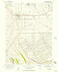
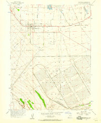
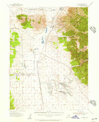
1955 Map of Grantsville
USGS Topo · Published 1957About this map
Grantsville and the nearby settlement of Marshall define this mid-century landscape on the southern edges of the Great Salt Lake basin. The town center is densely plotted with historic infrastructure, including the High Sch, a local Cem, and the Grantsville Fort Historic Marker, suggesting a community deeply rooted in its early pioneer history. To the south, the massive footprint of the Tooele Ordnance Depot dominates the terrain, with its grid of storage bunkers and rail spurs illustrating the significant military presence in Tooele County during the Cold War era. Water management is critical in this arid environment, evidenced by numerous Artesian Wells, the Flood Control Dam on Box Elder Wash, and the perennial flows of North Willow Creek and South Willow Creek. The Western Pacific railroad and a local Landing Strip facilitate transportation through this valley of alkaline flats and mountain runoff.
Find a feature on this map
27 named features on this map. Tap any name to fly to it.
Don’t see what you’re looking for? This feature index may not catch every label — zoom into the map to look around manually.
Map Details
Editions of this 1955 Grantsville Map
2 editions found
Other maps of this area

1885 · Tooele Valley
USGS Topo · 1:250,000

1918 · Stockton
USGS Topo · 1:62,500

1953 · Tooele
USGS Topo · 1:250,000
1955 · Timpie
USGS Topo · 1:62,500

1955 · Mills Junction
USGS Topo · 1:24,000
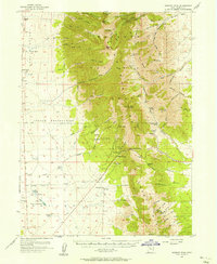
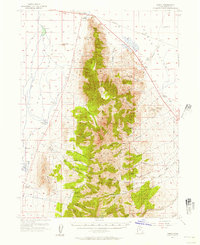
1955 · Deseret Peak
USGS Topo · 1:62,500

1955 · Burmester
USGS Topo · 1:24,000
1955 · Stockton
USGS Topo · 1:62,500

1955 · Tooele
USGS Topo · 1:250,000
1955 · Tooele
USGS Topo · 1:24,000