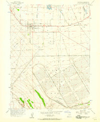
1955 Map of Grantsville
USGS Topo · Published 1960About this map
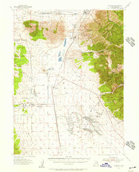
The Tooele Valley landscape near the base of the mountains is defined here by a delicate water system of artesian wells and seasonal washes. Grantsville serves as the primary hub, where the grid of Main Street, Clark Street, and Durfee Street transitions into agricultural allotments and open range. Local heritage is specifically noted at the Grantsville Fort Historic Marker, while the community’s mid-century infrastructure includes a High Sch, a Cem, and a local Landing Strip.
Find a feature on this map
31 named features on this map. Tap any name to fly to it.
Don’t see what you’re looking for? This feature index may not catch every label — zoom into the map to look around manually.
Map Details
Editions of this 1955 Grantsville Map
2 editions found
Other maps of this area

1885 · Tooele Valley
USGS Topo · 1:250,000

1918 · Stockton
USGS Topo · 1:62,500

1953 · Tooele
USGS Topo · 1:250,000
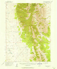
1955 · Timpie
USGS Topo · 1:62,500

1955 · Mills Junction
USGS Topo · 1:24,000
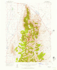
1955 · Deseret Peak
USGS Topo · 1:62,500

1955 · Burmester
USGS Topo · 1:24,000
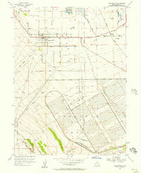
1955 · Grantsville
USGS Topo · 1:24,000
1955 · Stockton
USGS Topo · 1:62,500

1955 · Tooele
USGS Topo · 1:250,000