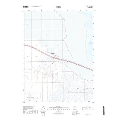
2020 Map of Burmester
USGS Topo · Published 2020About this map
Great Salt Lake's southern margin meets the marshy expanses of the Tooele Valley in this 2020 record of the northern Utah landscape. The settlement of Burmester sits at the intersection of major transportation corridors, surrounded by a complex network of wetlands and seasonal water bodies. To the south, the city of Grantsville and the nearby Willow Fields represent the primary residential hubs, anchored by agricultural history and proximity to Cooleys Slough.
Find a feature on this map
15 named features on this map. Tap any name to fly to it.
Don’t see what you’re looking for? This feature index may not catch every label — zoom into the map to look around manually.
Map Details
Editions of this 2020 Burmester Map
This is the sole edition of this map. No revisions or reprints were ever made.
Other maps of this area

1885 · Tooele Valley
USGS Topo · 1:250,000

1953 · Tooele
USGS Topo · 1:250,000

1955 · Timpie
USGS Topo · 1:62,500

1955 · Mills Junction
USGS Topo · 1:24,000

1955 · Burmester
USGS Topo · 1:24,000

1955 · Grantsville
USGS Topo · 1:24,000

1955 · Tooele
USGS Topo · 1:250,000

1955 · Tooele
USGS Topo · 1:24,000

1968 · Plug Peak SE
USGS Topo · 1:24,000

1968 · Corral Canyon
USGS Topo · 1:24,000