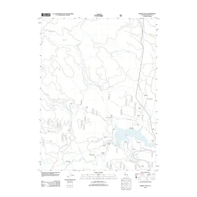
2012 Map of Burney Falls
USGS Topo · Published 2012About this map
Burney Falls stands as the centerpiece of this northern California landscape, where Burney Creek descends toward its confluence with the Pit River. The map details the mid-twentieth-century development around Lake Britton, showing a network of recreational and industrial sites such as Camp Britton, Clark Creek Lodge, and Northshore Campground. To the east, the settlement of Cayton and Cayton Valley reflect the area's agricultural and transportation history, anchored by the Cayton Siding. The map also preserves the location of the Pioneer Cem near the shoreline, a vital reference for local genealogists. In the uplands, features like Bird Flat, Delucci Ridge, and Powder Spur define the terrain, while numerous forest routes such as Bird Flat Rd and Clark Creek Rd provide access to high-altitude lakes like Smokey Lake and Owl Lake.
Find a feature on this map
68 named features on this map. Tap any name to fly to it.
Don’t see what you’re looking for? This feature index may not catch every label — zoom into the map to look around manually.
Map Details
Editions of this 2012 Burney Falls Map
This is the sole edition of this map. No revisions or reprints were ever made.
Other maps of this area

1886 · Lassen Peak
USGS Topo · 1:250,000

1886 · Modoc Lava Bed
USGS Topo · 1:250,000

1892 · Modoc Lava-Bed
USGS Topo · 1:250,000

1892 · Lassen Peak
USGS Topo · 1:250,000

1894 · Lassen Peak
USGS Topo · 1:250,000

1932 · Bartle
USGS Topo · 1:96,000

1935 · Burney
USGS Topo · 1:96,000

1939 · Burney
USGS Topo · 1:125,000

1939 · Bartle
USGS Topo · 1:125,000

1954 · Alturas
USGS Topo · 1:250,000