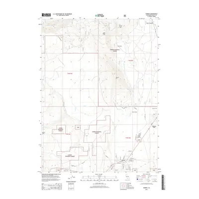
2015 Map of Burney
USGS Topo · Published 2015About this map
Burney sits at the southern edge of this Shasta County landscape, serving as a gateway between the lowlands of Goose Valley and the high volcanic peaks of the Cascade Range. The map illustrates a complex transition from the agricultural flats along Goose Creek to the timbered heights of Lookout Mtn and Burney Spring Mtn. This area is a critical intersection of public lands, where the boundaries of the Shasta National Forest meet the Lassen National Forest. Evidence of regional infrastructure is found along the Pit River in the north, specifically at the Pit No 1 Powerhouse. Modern residential patterns are visible in the layout of Johnson Park and the centralized hub of Burney, including local landmarks like the Burney Cemetery. To the northeast, the crossroads at Four Corners marks the route toward more remote northern terrain.
Find a feature on this map
47 named features on this map. Tap any name to fly to it.
Don’t see what you’re looking for? This feature index may not catch every label — zoom into the map to look around manually.
Map Details
Editions of this 2015 Burney Map
This is the sole edition of this map. No revisions or reprints were ever made.
Other maps of this area

1886 · Lassen Peak
USGS Topo · 1:250,000

1886 · Modoc Lava Bed
USGS Topo · 1:250,000

1892 · Modoc Lava-Bed
USGS Topo · 1:250,000

1892 · Lassen Peak
USGS Topo · 1:250,000

1894 · Lassen Peak
USGS Topo · 1:250,000

1932 · Bartle
USGS Topo · 1:96,000

1935 · Burney
USGS Topo · 1:96,000

1939 · Burney
USGS Topo · 1:125,000

1939 · Bartle
USGS Topo · 1:125,000

1954 · Alturas
USGS Topo · 1:250,000