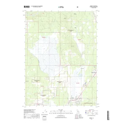
2018 Map of Burney
USGS Topo · Published 2018About this map
Burney sits at the junction of forested mountain slopes and the broad, open expanse of Goose Valley, illustrating the intersection of timberlands and agricultural valley floors in Shasta County. The landscape is defined by its transition from the peaks of Burney Spring Mtn and Lookout Mtn down into the riparian corridors of Burney Creek and the Pit River. Settlement patterns are concentrated along the valley edges, with the community of Johnson Park appearing to the northeast and the residential grid of Burney anchored by the Burney Cem. This area serves as a gateway between two major protected lands, with the Shasta National Forest bordering the north and the Lassen National Forest encompassing much of the southern terrain. Local landmarks like Haynes Flat and Aubrey Ridge provide further geographic context to this late 2010s survey of the Cascade foothills.
Find a feature on this map
51 named features on this map. Tap any name to fly to it.
Don’t see what you’re looking for? This feature index may not catch every label — zoom into the map to look around manually.
Map Details
Editions of this 2018 Burney Map
This is the sole edition of this map. No revisions or reprints were ever made.
Other maps of this area

1886 · Lassen Peak
USGS Topo · 1:250,000

1886 · Modoc Lava Bed
USGS Topo · 1:250,000

1892 · Modoc Lava-Bed
USGS Topo · 1:250,000

1892 · Lassen Peak
USGS Topo · 1:250,000

1894 · Lassen Peak
USGS Topo · 1:250,000

1932 · Bartle
USGS Topo · 1:96,000

1935 · Burney
USGS Topo · 1:96,000

1939 · Burney
USGS Topo · 1:125,000

1939 · Bartle
USGS Topo · 1:125,000

1954 · Alturas
USGS Topo · 1:250,000