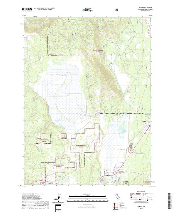
2022 Map of Burney
USGS Topo · Published 2022About this map
Burney serves as the primary hub for this section of Shasta County, situated at the junction where Ca 299 meets a network of timber and forest roads. The landscape is defined by the significant hydrological complex of Goose Valley, a broad wetland area fed by Burney Creek and Goose Cr. To the north, the Pit River cuts through the terrain near Burney Spring Mtn, marking a dramatic shift from the valley floor to the surrounding highlands.
Find a feature on this map
46 named features on this map. Tap any name to fly to it.
Don’t see what you’re looking for? This feature index may not catch every label — zoom into the map to look around manually.
Map Details
Editions of this 2022 Burney Map
This is the sole edition of this map. No revisions or reprints were ever made.
Other maps of this area

1886 · Lassen Peak
USGS Topo · 1:250,000

1886 · Modoc Lava Bed
USGS Topo · 1:250,000

1892 · Modoc Lava-Bed
USGS Topo · 1:250,000

1892 · Lassen Peak
USGS Topo · 1:250,000

1894 · Lassen Peak
USGS Topo · 1:250,000

1932 · Bartle
USGS Topo · 1:96,000

1935 · Burney
USGS Topo · 1:96,000

1939 · Burney
USGS Topo · 1:125,000

1939 · Bartle
USGS Topo · 1:125,000

1954 · Alturas
USGS Topo · 1:250,000