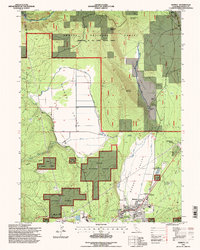
1995 Map of Burney
USGS Topo · Published 1998About this map
Burney serves as the primary hub in this mid-1990s landscape, positioned where the valley floor meets the rising timberlands of the Lassen National Forest. The map illustrates a complex water management system through an extensive network of Ditch lines and a Road on Levee along Burney Creek, highlighting the area's transition from agricultural use in Goose Valley to industrial activity. Local industry is anchored by a Lumber Mill and a Powerhouse near the Pit River, while the presence of the Radio Facility KARZ and a nearby Landing Strip reflect the technical infrastructure of the era. Smaller residential clusters like Johnson Park and working operations such as Goose Valley Ranch and Black Ranch provide specific points of interest for genealogists and local historians tracing the development of Shasta County during the late 20th century.
Find a feature on this map
37 named features on this map. Tap any name to fly to it.
Don’t see what you’re looking for? This feature index may not catch every label — zoom into the map to look around manually.
Map Details
Editions of this 1995 Burney Map
This is the sole edition of this map. No revisions or reprints were ever made.
Other maps of this area

1886 · Lassen Peak
USGS Topo · 1:250,000

1886 · Modoc Lava Bed
USGS Topo · 1:250,000

1892 · Modoc Lava-Bed
USGS Topo · 1:250,000

1892 · Lassen Peak
USGS Topo · 1:250,000

1894 · Lassen Peak
USGS Topo · 1:250,000

1932 · Bartle
USGS Topo · 1:96,000

1935 · Burney
USGS Topo · 1:96,000

1939 · Burney
USGS Topo · 1:125,000

1939 · Bartle
USGS Topo · 1:125,000

1954 · Alturas
USGS Topo · 1:250,000