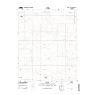
2013 Map of Burnham Trading Post
USGS Topo · Published 2013About this map
Burnham Trading Post marks a significant cultural and commercial point in the high desert landscape of San Juan County, New Mexico. This 2013 survey reveals the importance of seasonal watercourses in defining the terrain, with Brimhall Wash cutting across the northern reaches and Teec-ni-di-tso Wash winding through the center. The vast, sparsely populated area is interconnected by Indian Service Rte, which serves as a primary artery for transport and communication across the Shiprock Agency lands. In the southern portion of the quadrangle, Hunter Wash creates distinct drainage patterns that influence the local topography. The map illustrates the traditional land divisions of the Public Land Survey System, showing the intersections of townships like T24N R15W and T25N R16W, which help organize this expansively open environment.
Find a feature on this map
12 named features on this map. Tap any name to fly to it.
Don’t see what you’re looking for? This feature index may not catch every label — zoom into the map to look around manually.
Map Details
Editions of this 2013 Burnham Trading Post Map
This is the sole edition of this map. No revisions or reprints were ever made.
Other maps of this area

1889 · Chaco
USGS Topo · 1:250,000

1892 · Chaco
USGS Topo · 1:250,000

1927 · Sulphur Spring
USGS Topo · 1:96,000

1928 · Kirtland
USGS Topo · 1:125,000

1932 · Kirtland
USGS Topo · 1:125,000

1954 · Shiprock
USGS Topo · 1:250,000

1958 · Shiprock
USGS Topo · 1:250,000

1959 · Shiprock
USGS Topo · 1:250,000
1966 · Newcomb NE
USGS Topo · 1:24,000
1966 · Burnham Trading Post
USGS Topo · 1:24,000