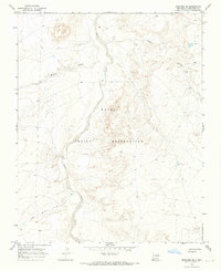
1966 Map of Newcomb NE
USGS Topo · Published 1969About this map
The Chaco River carves a dominant path through this corner of the Navajo Indian Reservation, defining a landscape where seasonal drainage and mineral exploration intersect. This mid-century survey captures the region's hydraulic network, featuring the prominent confluence of Sanostee Wash and the braided channels of the river. The topography is further shaped by deep-cutting waterways such as Pinabete Arroyo and Peña Blanca Arroyo, which illustrate the erosion patterns of the San Juan Basin. Beyond the natural landforms, the map documents early industrial activity in the form of a Mine and a Drill Hole, providing a record of resource extraction efforts within the reservation during the 1960s. For those studying the geological and industrial history of this high-desert region, these markers offer a specific look at the intersection of traditional land use and modern geological surveying.
Find a feature on this map
8 named features on this map. Tap any name to fly to it.
Don’t see what you’re looking for? This feature index may not catch every label — zoom into the map to look around manually.
Map Details
Editions of this 1966 Newcomb NE Map
2 editions found
Other maps of this area

1889 · Chaco
USGS Topo · 1:250,000

1892 · Chaco
USGS Topo · 1:250,000

1927 · Sulphur Spring
USGS Topo · 1:96,000

1928 · Kirtland
USGS Topo · 1:125,000

1932 · Kirtland
USGS Topo · 1:125,000

1954 · Shiprock
USGS Topo · 1:250,000

1958 · Shiprock
USGS Topo · 1:250,000

1959 · Shiprock
USGS Topo · 1:250,000
1966 · Burnham Trading Post
USGS Topo · 1:24,000
1966 · Table Mesa
USGS Topo · 1:24,000