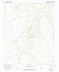
1966 Map of Newcomb NE
USGS Topo · Published 1990About this map
The Navajo Indian Reservation landscape is defined by the carved paths of the Chaco River and its seasonal tributaries in the high desert of northwestern New Mexico. This mid-century topographical record shows the intricate drainage systems of Sanostee Wash and Pinabete Arroyo as they snake through the high plateaus. While the area remains largely unpopulated by major settlements, the presence of a Mine, Drill Hole, and multiple scattered Well sites indicates a period of focused resource exploration and subsurface survey across these tribal lands. The map also traces the Peña Blanca Arroyo, illustrating the complex natural erosion patterns that have shaped the San Juan basin over millennia.
Find a feature on this map
8 named features on this map. Tap any name to fly to it.
Don’t see what you’re looking for? This feature index may not catch every label — zoom into the map to look around manually.
Map Details
Editions of this 1966 Newcomb NE Map
2 editions found
Other maps of this area

1889 · Chaco
USGS Topo · 1:250,000

1892 · Chaco
USGS Topo · 1:250,000

1927 · Sulphur Spring
USGS Topo · 1:96,000

1928 · Kirtland
USGS Topo · 1:125,000

1932 · Kirtland
USGS Topo · 1:125,000

1954 · Shiprock
USGS Topo · 1:250,000

1958 · Shiprock
USGS Topo · 1:250,000

1959 · Shiprock
USGS Topo · 1:250,000
1966 · Newcomb NE
USGS Topo · 1:24,000
1966 · Burnham Trading Post
USGS Topo · 1:24,000