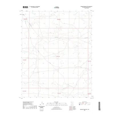
2020 Map of Burnham Trading Post
USGS Topo · Published 2020About this map
Burnham Trading Post serves as the focal point of this arid landscape, situated in the northwestern corner of the quadrangle. The terrain is defined by a network of drainage systems that carve through the high desert, most notably the winding Teec-ni-di-tso Wash and Brimhall Wash. These seasonal waterways illustrate the natural drainage patterns that dictate movement and settlement in the region. Transportation across this expanse is facilitated by established routes such as Rte 7295 and Indian Svc Rte 5080, which provide access to the remote backcountry. The map also delineates several township boundaries, including t24n r15w and t25n r15w, providing a clear record of modern land division in the Shiprock Agency area.
Find a feature on this map
14 named features on this map. Tap any name to fly to it.
Don’t see what you’re looking for? This feature index may not catch every label — zoom into the map to look around manually.
Map Details
Editions of this 2020 Burnham Trading Post Map
This is the sole edition of this map. No revisions or reprints were ever made.
Other maps of this area

1889 · Chaco
USGS Topo · 1:250,000

1892 · Chaco
USGS Topo · 1:250,000

1927 · Sulphur Spring
USGS Topo · 1:96,000

1928 · Kirtland
USGS Topo · 1:125,000

1932 · Kirtland
USGS Topo · 1:125,000

1954 · Shiprock
USGS Topo · 1:250,000

1958 · Shiprock
USGS Topo · 1:250,000

1959 · Shiprock
USGS Topo · 1:250,000
1966 · Newcomb NE
USGS Topo · 1:24,000
1966 · Burnham Trading Post
USGS Topo · 1:24,000