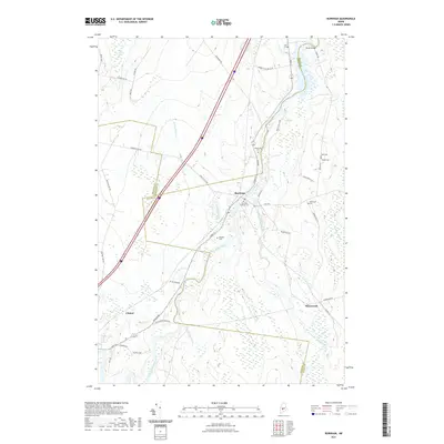
2021 Map of Burnham
USGS Topo · Published 2021About this map
The Sebasticook River serves as the central geographic feature of this area, where the borders of Somerset, Waldo, and Kennebec Counties converge. The settlement of Burnham sits at a strategic bend in the river, characterized by a concentration of local history markers including the Burnham Village Cem and Mudgett Cem. The landscape is defined by the convergence of several waterways, including Twentyfive Mile Stream and Johnson Brook, which flow through low-lying marshlands and wetlands. To the south, the village of Winnecook remains connected via Winnecook Rd, while the western edge reaches toward Clinton. For genealogists, the map is particularly detailed, identifying numerous burial grounds such as Weymouth Cem, Sideling Cem, and Carr Cem that serve as waypoints across this multi-county junction.
Find a feature on this map
44 named features on this map. Tap any name to fly to it.
Don’t see what you’re looking for? This feature index may not catch every label — zoom into the map to look around manually.
Map Details
Editions of this 2021 Burnham Map
This is the sole edition of this map. No revisions or reprints were ever made.
Other maps of this area

1892 · Waterville
USGS Topo · 1:62,500

1913 · Skowhegan
USGS Topo · 1:62,500

1926 · Burnham
USGS Topo · 1:62,500

1930 · Pittsfield
USGS Topo · 1:48,000

1932 · Pittsfield
USGS Topo · 1:62,500

1933 · Pittsfield
USGS Topo · 1:62,500

1943 · Waterville
USGS Topo · 1:62,500

1948 · Bangor
USGS Topo · 1:250,000

1955 · Pittsfield
USGS Topo · 1:62,500

1955 · Skowhegan
USGS Topo · 1:62,500