
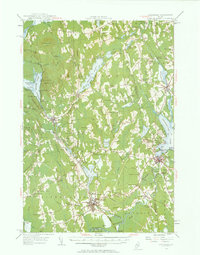
1955 Map of Pittsfield
USGS Topo · Published 1957About this map
Pittsfield and the surrounding Somerset County landscape are defined by a complex network of waterways and early rural settlements in the mid-1950s. The Maine Central railroad serves as a primary industrial corridor, threading through the bustling centers of Hartland and Corinna. Away from the rail lines, the terrain is dotted with family-named corners such as Nutter Corner and Manson Corner, reflecting the agricultural and genealogical roots of the region.
Find a feature on this map
115 named features on this map. Tap any name to fly to it.
Don’t see what you’re looking for? This feature index may not catch every label — zoom into the map to look around manually.
Map Details
Editions of this 1955 Pittsfield Map
2 editions found
Other maps of this area

1892 · Waterville
USGS Topo · 1:62,500

1913 · Skowhegan
USGS Topo · 1:62,500

1926 · Burnham
USGS Topo · 1:62,500

1930 · Pittsfield
USGS Topo · 1:48,000

1931 · Stetson
USGS Topo · 1:48,000

1932 · Brooks
USGS Topo · 1:62,500

1932 · Dover-Foxcroft
USGS Topo · 1:48,000

1932 · Pittsfield
USGS Topo · 1:62,500

1933 · Pittsfield
USGS Topo · 1:62,500

1933 · Guilford
USGS Topo · 1:62,500