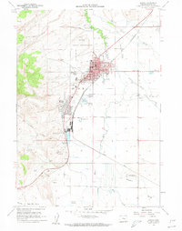
1960 Map of Burns
USGS Topo · Published 1962About this map
The high desert communities of Burns and Hines are documented here during a period of mid-century development. The Northwestern Pacific railroad corridor serves as the industrial spine of the region, connecting the residential areas with local industry and the Oregon Agricultural Experimental Sta to the south. The complex geography of the Silvies River and its numerous branches, including Whiting Slough and Newman Slough, illustrates the vital role of water management in this arid landscape. Cultural landmarks like the Indian Reservation and Indian Village sit on the western edge of the city, while civic life is anchored by the Courthouse and local schools such as Washington Sch and Filmore Sch. The transition from town to timber and range is evidenced by a private logging road and several gravel pits scattered toward the Sage Hen Valley.
Find a feature on this map
43 named features on this map. Tap any name to fly to it.
Don’t see what you’re looking for? This feature index may not catch every label — zoom into the map to look around manually.
Map Details
Editions of this 1960 Burns Map
2 editions found
Other maps of this area

1955 · Burns
USGS Topo · 1:250,000

1958 · Burns
USGS Topo · 1:250,000

1959 · Burns
USGS Topo · 1:250,000

1959 · Harney
USGS Topo · 1:62,500

1959 · Dog Mountain
USGS Topo · 1:62,500

1959 · Lawen
USGS Topo · 1:62,500

1960 · Burns
USGS Topo · 1:62,500

1960 · Burns
USGS Topo · 1:24,000

1975 · Burns
USGS Topo · 1:24,000

1978 · Malheur Lake
USGS Topo · 1:100,000