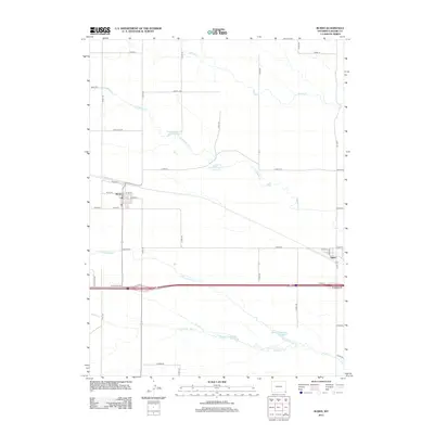
2012 Map of Burns
USGS Topo · Published 2012About this map
The town of Burns anchors this Laramie County landscape, positioned along a grid of residential streets like W 1st St and E 4th St just north of the Burns Cem. The area's agricultural and water-management character is evident through a series of named catchments, including Thomas Reservoir Number 1 and Thomas Reservoir Number 2 which draw from Lodgepole Cr. To the southeast, the small settlement of Egbert sits near the junction of Co Rd 212 and Co Rd 154.
Find a feature on this map
38 named features on this map. Tap any name to fly to it.
Don’t see what you’re looking for? This feature index may not catch every label — zoom into the map to look around manually.
Map Details
Editions of this 2012 Burns Map
This is the sole edition of this map. No revisions or reprints were ever made.
Other maps of this area

1954 · Cheyenne
USGS Topo · 1:250,000

1958 · Cheyenne
USGS Topo · 1:250,000

1963 · Arcola
USGS Topo · 1:24,000

1963 · Burns
USGS Topo · 1:24,000

1963 · Midway SE
USGS Topo · 1:24,000

1963 · Carpenter
USGS Topo · 1:24,000

1963 · Pine Bluffs SW
USGS Topo · 1:24,000

1963 · Midway SW
USGS Topo · 1:24,000
1963 · Hillsdale
USGS Topo · 1:24,000

1963 · Tracy
USGS Topo · 1:24,000