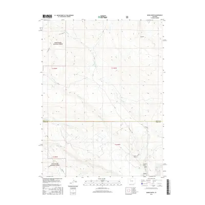
2016 Map of Burns North
USGS Topo · Published 2016About this map
White River National Forest lands dominate this high-altitude landscape, where the Colorado River cuts through the southeastern corner near the small settlement of Burns. The terrain is defined by dramatic elevation changes, notably across King Mtn and the broad expanse of Derby Mesa. Water management is central to the area's history, evidenced by the S Derby Ditch and numerous drainages like Cabin Cr and Derby Cr that feed into the larger river system. Historical transport routes are represented by the Ute Sunnyside Trail, while local place names such as Hangmans Rock, Pump Gulch, and Fargo Gulch offer a window into the lore and land-use patterns of Eagle County.
Find a feature on this map
26 named features on this map. Tap any name to fly to it.
Don’t see what you’re looking for? This feature index may not catch every label — zoom into the map to look around manually.
Map Details
Editions of this 2016 Burns North Map
This is the sole edition of this map. No revisions or reprints were ever made.
Other maps of this area

1927 · Glenwood Springs
USGS Topo · 1:125,000

1930 · Glenwood Springs
USGS Topo · 1:125,000

1954 · Craig
USGS Topo · 1:250,000

1957 · Craig
USGS Topo · 1:250,000

1957 · Leadville
USGS Topo · 1:250,000

1958 · Craig
USGS Topo · 1:250,000

1959 · Leadville
USGS Topo · 1:250,000

1960 · Leadville
USGS Topo · 1:250,000

1960 · Craig
USGS Topo · 1:250,000

1962 · Leadville
USGS Topo · 1:250,000