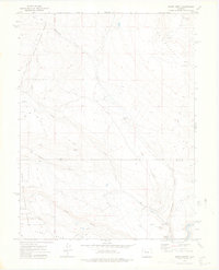
1972 Map of Burns North
USGS Topo · Published 1975About this map
King Mountain dominates the northern reaches of this high-altitude landscape, where the Routt and Eagle County line divides a network of steep drainages and plateaus. Settlement is concentrated in the southern valleys near the Colorado River, particularly around the small community of Burns and the nearby Truitt site. The infrastructure of the early 1970s reflects a balance of transportation and resource management, evidenced by the D & R G W railroad tracks following the river bend and the Derby Guard Sta overseeing the White River National Forest.
Find a feature on this map
27 named features on this map. Tap any name to fly to it.
Don’t see what you’re looking for? This feature index may not catch every label — zoom into the map to look around manually.
Map Details
Editions of this 1972 Burns North Map
This is the sole edition of this map. No revisions or reprints were ever made.
Other maps of this area

1927 · Glenwood Springs
USGS Topo · 1:125,000

1930 · Glenwood Springs
USGS Topo · 1:125,000

1954 · Craig
USGS Topo · 1:250,000

1957 · Craig
USGS Topo · 1:250,000

1957 · Leadville
USGS Topo · 1:250,000

1958 · Craig
USGS Topo · 1:250,000

1959 · Leadville
USGS Topo · 1:250,000

1960 · Leadville
USGS Topo · 1:250,000

1960 · Craig
USGS Topo · 1:250,000

1962 · Leadville
USGS Topo · 1:250,000