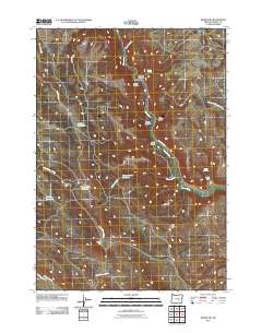
2011 Map of Burns NW
USGS Topo · Published 2011About this map
Silvies River anchors this high-desert landscape in Harney County, carving through notable geological formations like Silvies Canyon, Boone Canyon, and Boulder Canyon. In this arid region, the management of water is evident through a series of human-made features such as Juniper Reservoir, Charlie-Creek Reservoir, and Shoeffer Reservoir. These water sources support a sparse network of isolated homesteads and ranching outposts, including the Thissel Ranch, Mayes Cabin, and the Old Cushman Ranch located further south along East Willow Creek. The road network is strictly utilitarian, consisting primarily of the Silvies River Rd and the Hines Logging Rd, reflecting an economy and lifestyle shaped by timber, grazing, and the dramatic topography of Big Basin and Mud Ridge.
Find a feature on this map
28 named features on this map. Tap any name to fly to it.
Don’t see what you’re looking for? This feature index may not catch every label — zoom into the map to look around manually.
Map Details
Editions of this 2011 Burns NW Map
This is the sole edition of this map. No revisions or reprints were ever made.
Other maps of this area

1955 · Burns
USGS Topo · 1:250,000

1958 · Burns
USGS Topo · 1:250,000

1959 · Burns
USGS Topo · 1:250,000

1959 · West Myrtle Butte
USGS Topo · 1:62,500

1959 · Sawtooth Creek
USGS Topo · 1:62,500

1960 · Burns
USGS Topo · 1:62,500

1960 · Burns
USGS Topo · 1:24,000

1975 · Burns
USGS Topo · 1:24,000

1981 · Sage Hen Hill
USGS Topo · 1:24,000
1981 · Holmes Canyon
USGS Topo · 1:24,000