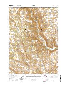
2017 Map of Burns NW
USGS Topo · Published 2017About this map
The Silvies River cuts through the high desert landscape of Harney County, following a course that defines the drainage patterns and historical land use of this region. This survey illustrates a complex network of water management through numerous small-scale catchments, including Juniper Reservoir, Charlie Creek Reservoir, and Green Flat Reservoir. The terrain is characterized by dramatic elevation shifts at Big Basin and the deep incisions of Silvies Canyon and Boone Canyon. Access to these remote reaches is maintained via the Silvies River Rd and the Burns-Izee Rd, highlighting the sparse but vital transportation corridors between Harney and Grant counties. Scattered water sources like Triple Springs and Cherry Spring emphasize the critical importance of reliable water in the arid eastern Oregon rangeland.
Find a feature on this map
35 named features on this map. Tap any name to fly to it.
Don’t see what you’re looking for? This feature index may not catch every label — zoom into the map to look around manually.
Map Details
Editions of this 2017 Burns NW Map
This is the sole edition of this map. No revisions or reprints were ever made.
Other maps of this area

1955 · Burns
USGS Topo · 1:250,000

1958 · Burns
USGS Topo · 1:250,000

1959 · Burns
USGS Topo · 1:250,000

1959 · West Myrtle Butte
USGS Topo · 1:62,500

1959 · Sawtooth Creek
USGS Topo · 1:62,500

1960 · Burns
USGS Topo · 1:62,500

1960 · Burns
USGS Topo · 1:24,000

1975 · Burns
USGS Topo · 1:24,000

1981 · Sage Hen Hill
USGS Topo · 1:24,000
1981 · Holmes Canyon
USGS Topo · 1:24,000