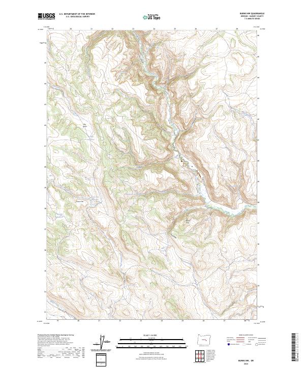
2024 Map of Burns NW
USGS Topo · Published 2024About this map
Silvies River winds through the heart of this Harney County landscape, carving deep relief through Silvies Canyon and Boone Canyon. The terrain is defined by a complex network of seasonal water management, evidenced by numerous upland catchments such as Juniper Reservoir, Green Flat Reservoir, and Shoeffer Reservoir. These features, alongside named springs like Jumbo Spring and Parker Spring, underscore the vital role of water sourcing in this high-desert environment.
Find a feature on this map
35 named features on this map. Tap any name to fly to it.
Don’t see what you’re looking for? This feature index may not catch every label — zoom into the map to look around manually.
Map Details
Editions of this 2024 Burns NW Map
This is the sole edition of this map. No revisions or reprints were ever made.
Other maps of this area

1955 · Burns
USGS Topo · 1:250,000

1958 · Burns
USGS Topo · 1:250,000

1959 · Burns
USGS Topo · 1:250,000

1959 · West Myrtle Butte
USGS Topo · 1:62,500

1959 · Sawtooth Creek
USGS Topo · 1:62,500

1960 · Burns
USGS Topo · 1:62,500

1960 · Burns
USGS Topo · 1:24,000

1975 · Burns
USGS Topo · 1:24,000

1981 · Sage Hen Hill
USGS Topo · 1:24,000
1981 · Holmes Canyon
USGS Topo · 1:24,000