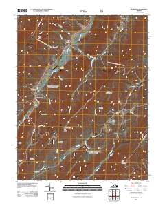
2011 Map of Burnsville
USGS Topo · Published 2011About this map
The Jackson River carves a deep path through this Appalachian landscape, serving as a focal point for early 21st-century settlement and topography in Bath County. The map details a series of high ridges and narrow valleys, including Piney Ridge and Wilson Mountain, which dictate the placement of communities like Burnsville and Bolar. Genealogists will find significant value in the documentation of local burial grounds, such as Big Valley Cemetery, Stony Run Cemetery, and Cleek Cemetery, which are often the primary remaining markers of family history in these rural corridors. Notable landmarks like the Duncan Knob Lookout on Duncan Ridge offer a glimpse into the forest management and observation network of the era. The presence of place names like Stillhouse Hollow and Pritt Hollow suggests a landscape deeply connected to local tradition and historical resource use, while Bolar Spring indicates the importance of natural water sources to the region's development.
Find a feature on this map
45 named features on this map. Tap any name to fly to it.
Don’t see what you’re looking for? This feature index may not catch every label — zoom into the map to look around manually.
Map Details
Editions of this 2011 Burnsville Map
This is the sole edition of this map. No revisions or reprints were ever made.
Other maps of this area

1901 · Monterey
USGS Topo · 1:125,000

1922 · Cass
USGS Topo · 1:48,000

1923 · Warm Springs
USGS Topo · 1:48,000

1924 · Cass
USGS Topo · 1:62,500

1926 · Warm Springs
USGS Topo · 1:62,500

1930 · Warm Springs Run
USGS Topo · 1:24,000

1933 · Warm Springs Run
USGS Topo · 1:31,680

1941 · Monterey
USGS Topo · 1:62,500

1944 · Monterey
USGS Topo · 1:62,500

1946 · Warm Springs
USGS Topo · 1:62,500