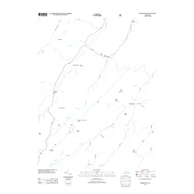
2013 Map of Burnsville
USGS Topo · Published 2013About this map
Burnsville and Bolar anchor this high-relief landscape in Bath County, where the Jackson River cuts through the western valleys and numerous runs drain the steep ridges of the Appalachians. The settlement pattern follows the narrow valley floors, most notably along Bolar Run and Little Valley Run, where small clusters like Bethel and Little Valley are found. The map reveals the persistence of family-named landmarks and historical infrastructure, including Stillhouse Hollow, Pritt Hollow, and Daggy Hollow, alongside mountain crossings like Bolar Gap. Local aviation is represented by Singleton Airport, situated near the river, while the higher elevations are marked by the Duncan Knob Lookout and the looming mass of Tower Hill Mountain. The abundance of named springs and runs, such as Bolar Spring and Muddy Run, underscores the importance of water resources in this deeply dissected terrain of the Virginia mountains.
Find a feature on this map
48 named features on this map. Tap any name to fly to it.
Don’t see what you’re looking for? This feature index may not catch every label — zoom into the map to look around manually.
Map Details
Editions of this 2013 Burnsville Map
This is the sole edition of this map. No revisions or reprints were ever made.
Other maps of this area

1901 · Monterey
USGS Topo · 1:125,000

1922 · Cass
USGS Topo · 1:48,000

1923 · Warm Springs
USGS Topo · 1:48,000

1924 · Cass
USGS Topo · 1:62,500

1926 · Warm Springs
USGS Topo · 1:62,500

1930 · Warm Springs Run
USGS Topo · 1:24,000

1933 · Warm Springs Run
USGS Topo · 1:31,680

1941 · Monterey
USGS Topo · 1:62,500

1944 · Monterey
USGS Topo · 1:62,500

1946 · Warm Springs
USGS Topo · 1:62,500