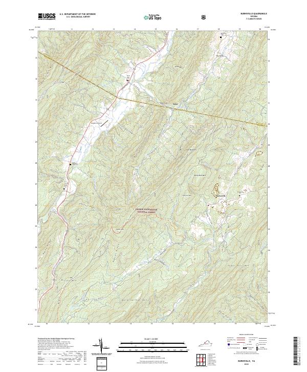
2022 Map of Burnsville
USGS Topo · Published 2022About this map
Burnsville and Bolar anchor this map of the Virginia highlands, where the Jackson River cuts through the narrow valleys of the George Washington National Forest. The landscape is defined by the sharp parallel ridges of Back Creek Mtn, Piney Ridge, and Warm Springs Mtn, creating isolated pockets of settlement connected by historic routes like Jackson River Rd and Big Valley Rd. Genealogical value is found in several family-named burial sites, including the George W Cleek Cem and Jacob Cleek Cem near Stillhouse Hollow. The map also reveals the aviation footprint of the Singleton Airport situated in the valley north of Pritt Hollow. This area reflects a classic Appalachian pattern of creek-side farming and mountain forestry, with numerous runs like Stony Run and Bolar Run draining the high ridges into the river system below.
Find a feature on this map
68 named features on this map. Tap any name to fly to it.
Don’t see what you’re looking for? This feature index may not catch every label — zoom into the map to look around manually.
Map Details
Editions of this 2022 Burnsville Map
This is the sole edition of this map. No revisions or reprints were ever made.
Other maps of this area

1901 · Monterey
USGS Topo · 1:125,000

1922 · Cass
USGS Topo · 1:48,000

1923 · Warm Springs
USGS Topo · 1:48,000

1924 · Cass
USGS Topo · 1:62,500

1926 · Warm Springs
USGS Topo · 1:62,500

1930 · Warm Springs Run
USGS Topo · 1:24,000

1933 · Warm Springs Run
USGS Topo · 1:31,680

1941 · Monterey
USGS Topo · 1:62,500

1944 · Monterey
USGS Topo · 1:62,500

1946 · Warm Springs
USGS Topo · 1:62,500