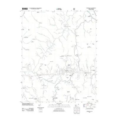
2011 Map of Burnsville
USGS Topo · Published 2011About this map
Burnsville serves as the central hub of this North Carolina highland region, where the Cane River and its numerous tributaries like Banks Creek and Phipps Creek carve through the mountain landscape. The map reveals a community structured around both its natural geography and institutional presence, featuring the North Carolina State Prison Camp and the Mount Mitchell Boys Camp. Historical land use is evident in the presence of the Ray Mine and several family-named burial grounds, including the Dellinger Cemetery and Roland Cemetery.
Find a feature on this map
186 named features on this map. Tap any name to fly to it.
Don’t see what you’re looking for? This feature index may not catch every label — zoom into the map to look around manually.
Map Details
Editions of this 2011 Burnsville Map
This is the sole edition of this map. No revisions or reprints were ever made.
Other maps of this area

1891 · Roan Mountain
USGS Topo · 1:125,000

1894 · Roan Mountain
USGS Topo · 1:125,000

1900 · Mount Mitchell
USGS Topo · 1:125,000

1902 · Mount Mitchell
USGS Topo · 1:125,000

1904 · Roan Mountain
USGS Topo · 1:125,000

1934 · Micaville
USGS Topo · 1:24,000

1934 · Parts Of Celo And Black Brothers
USGS Topo · 1:24,000

1934 · Bakersville
USGS Topo · 1:24,000

1935 · Black Brothers
USGS Topo · 1:24,000

1935 · Chestoa
USGS Topo · 1:24,000