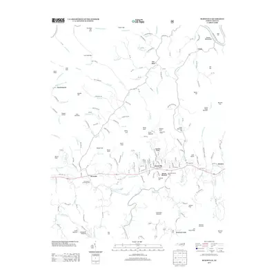
2013 Map of Burnsville
USGS Topo · Published 2013About this map
Burnsville serves as the central hub of this mountain landscape, where the Cane River and its numerous tributaries like Jacks Creek and Mine Fork shape the local geography. The map captures the Yancey County seat alongside specialized sites like the North Carolina State Prison Camp and the Mount Mitchell Boys Camp. Smaller settlements such as Day Book, Windom, and Toledo are linked by a network of state routes including NC-1335 and NC-1350, which navigate through gaps like Cooper Gap and Wolfpit Gap. High-altitude landmarks such as Phillips Knob Lookout and Mount Mitchell dominate the southern views, while the winding course of the Cane River provides a lifeline through Riverside. Genealogists may find interest in the numerous family-named features like McWilliams Branch, Anglin Knob, and Joe Young Ridge that suggest deep roots in these ridges.
Find a feature on this map
199 named features on this map. Tap any name to fly to it.
Don’t see what you’re looking for? This feature index may not catch every label — zoom into the map to look around manually.
Map Details
Editions of this 2013 Burnsville Map
This is the sole edition of this map. No revisions or reprints were ever made.
Other maps of this area

1891 · Roan Mountain
USGS Topo · 1:125,000

1894 · Roan Mountain
USGS Topo · 1:125,000

1900 · Mount Mitchell
USGS Topo · 1:125,000

1902 · Mount Mitchell
USGS Topo · 1:125,000

1904 · Roan Mountain
USGS Topo · 1:125,000

1934 · Micaville
USGS Topo · 1:24,000

1934 · Parts Of Celo And Black Brothers
USGS Topo · 1:24,000

1934 · Bakersville
USGS Topo · 1:24,000

1935 · Black Brothers
USGS Topo · 1:24,000

1935 · Chestoa
USGS Topo · 1:24,000