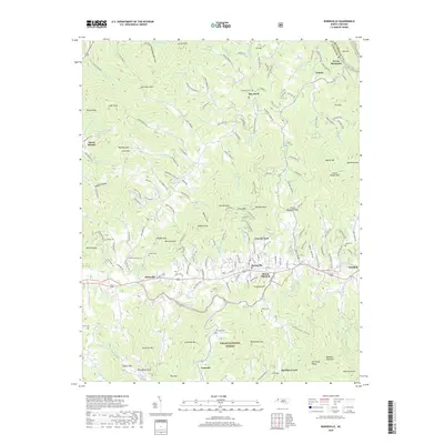
2019 Map of Burnsville
USGS Topo · Published 2019About this map
The Burnsville valley serves as a central hub where the Cane River meets its numerous tributaries, including Pine Swamp Br and Boulens Cr. This 2019 survey documents the expansion of neighborhoods like Lincoln Park and Riverside while preserving the rural character of mountain gaps and coves. The landscape is defined by its topographic extremes, from the high peaks of Mount Mitchell and Cane Mtn to the deep recesses of Pounding Mill Cove and Roland Hollow. Local family history is etched into the terrain through numerous burial grounds such as Edney Cem, Banks Cem, and Dellinger Cem. To the south, the protected boundaries of the Pisgah National Forest frame the developed corridors, illustrating the balance between township growth and forest preservation in the Blue Ridge region.
Find a feature on this map
180 named features on this map. Tap any name to fly to it.
Don’t see what you’re looking for? This feature index may not catch every label — zoom into the map to look around manually.
Map Details
Editions of this 2019 Burnsville Map
This is the sole edition of this map. No revisions or reprints were ever made.
Other maps of this area

1891 · Roan Mountain
USGS Topo · 1:125,000

1894 · Roan Mountain
USGS Topo · 1:125,000

1900 · Mount Mitchell
USGS Topo · 1:125,000

1902 · Mount Mitchell
USGS Topo · 1:125,000

1904 · Roan Mountain
USGS Topo · 1:125,000

1934 · Micaville
USGS Topo · 1:24,000

1934 · Parts Of Celo And Black Brothers
USGS Topo · 1:24,000

1934 · Bakersville
USGS Topo · 1:24,000

1935 · Black Brothers
USGS Topo · 1:24,000

1935 · Chestoa
USGS Topo · 1:24,000