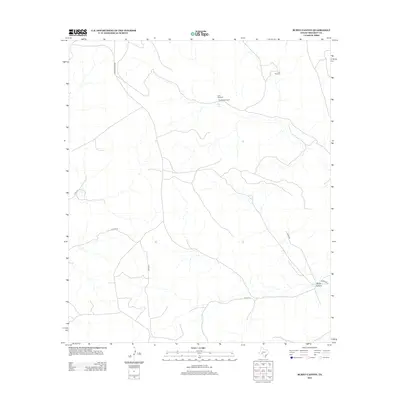
2012 Map of Burnt Canyon
USGS Topo · Published 2012About this map
Burnt Canyon gives its name to this high-plains landscape in Crockett County, where the infrastructure of West Texas ranching and water management is etched across the terrain. Vital water sources are marked by the presence of Clay Tank, Clay Tank Windmill, and Little Windmill, reflecting the critical importance of reliable hydration in this semi-arid environment. The transportation network is defined by several remote county routes, including Dunlap Rd and Hoover Divide Rd, which navigate the subtle drainage patterns and canyon systems. This 2012 topographic survey documents a persistent ranching frontier, where naming conventions like East Windmill speak to the practical necessities of identifying landmark locations across a sparsely populated area.
Find a feature on this map
11 named features on this map. Tap any name to fly to it.
Don’t see what you’re looking for? This feature index may not catch every label — zoom into the map to look around manually.
Map Details
Editions of this 2012 Burnt Canyon Map
This is the sole edition of this map. No revisions or reprints were ever made.
Other maps of this area

1929 · Sheffield
USGS Topo · 1:125,000

1954 · Sonora
USGS Topo · 1:250,000

1958 · Sonora
USGS Topo · 1:250,000

1967 · Burnt Canyon
USGS Topo · 1:24,000

1967 · Pikes Peak
USGS Topo · 1:24,000

1967 · Fort Lancaster
USGS Topo · 1:24,000

1967 · Bachelor Hill
USGS Topo · 1:24,000

1967 · Dead Man Canyon
USGS Topo · 1:24,000

1967 · Mitchell Canyon
USGS Topo · 1:24,000

1970 · Howards Well
USGS Topo · 1:24,000