
1967 Map of Dead Man Canyon
USGS Topo · Published 1970About this map
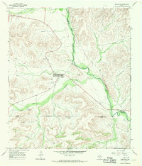
Dead Man Canyon and Reagan Canyon dominate this West Texas landscape, cutting deeply through the limestone plateaus of the Trans-Pecos region. This survey, conducted in the late 1960s, documents a sparsely populated frontier along the Terrell Co - Crockett Co line, where the Pecos River carves a winding path southward. One of the most unique local markers is the Dead Man Windmill Grave, a site suggesting the stark realities of early ranching life in this isolated territory.
Find a feature on this map
15 named features on this map. Tap any name to fly to it.
Don’t see what you’re looking for? This feature index may not catch every label — zoom into the map to look around manually.
Map Details
Editions of this 1967 Dead Man Canyon Map
This is the sole edition of this map. No revisions or reprints were ever made.
Other maps of this area

1929 · Sheffield
USGS Topo · 1:125,000

1954 · Sonora
USGS Topo · 1:250,000

1958 · Sonora
USGS Topo · 1:250,000

1967 · Burnt Canyon
USGS Topo · 1:24,000

1967 · Fort Lancaster
USGS Topo · 1:24,000

1967 · Bachelor Hill
USGS Topo · 1:24,000

1967 · Sheffield SE
USGS Topo · 1:24,000
1967 · Sheffield
USGS Topo · 1:24,000
1970 · Prince Albert Draw
USGS Topo · 1:24,000
1973 · Sixshooter Canyon
USGS Topo · 1:24,000