
1967 Map of Sheffield SE
USGS Topo · Published 1970About this map
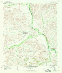
Deep incisions of the Texas landscape dominate this 1967 survey of eastern Terrell County, where Reagan Canyon and Harkey Draw carve through the limestone plateau. The isolation of the Trans-Pecos region is evident in the sparse infrastructure, centered primarily around the Allison Ranch and its supporting Landing Strip and Landing Area. This environment relied heavily on subsurface water management for livestock, as indicated by the presence of the East Martin Windmill and Farm Tank Windmill. In the southern reaches, Independence Creek provides a rare perennial water course amidst the arid terrain. The map also reveals the industrial footprint of the era through scattered Gravel Pits and numerous Drill Holes, reflecting active mineral or water exploration during the late 1960s.
Find a feature on this map
10 named features on this map. Tap any name to fly to it.
Don’t see what you’re looking for? This feature index may not catch every label — zoom into the map to look around manually.
Map Details
Editions of this 1967 Sheffield SE Map
This is the sole edition of this map. No revisions or reprints were ever made.
Other maps of this area

1929 · Sheffield
USGS Topo · 1:125,000

1954 · Sonora
USGS Topo · 1:250,000

1958 · Sonora
USGS Topo · 1:250,000

1967 · Sheffield NW
USGS Topo · 1:24,000

1967 · Horsehead Canyon
USGS Topo · 1:24,000

1967 · Fort Lancaster
USGS Topo · 1:24,000

1967 · Dead Man Canyon
USGS Topo · 1:24,000
1967 · Sheffield
USGS Topo · 1:24,000
1973 · Sixshooter Canyon
USGS Topo · 1:24,000
1980 · Oasis Ranch
USGS Topo · 1:24,000