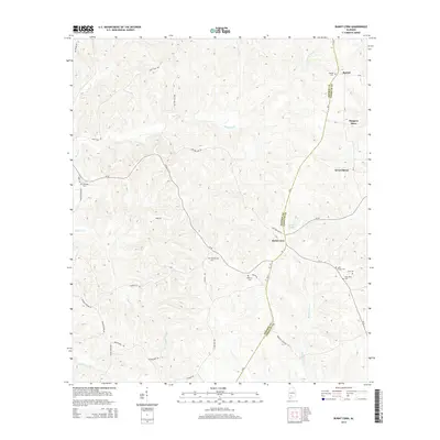
2014 Map of Burnt Corn
USGS Topo · Published 2014About this map
The boundary between Monroe County and Conecuh County divides this portion of Alabama, where the settlement of Burnt Corn serves as a focal point for the surrounding rural landscape. This area is characterized by a significant density of family and community burial grounds, including Ramah Cem, Puryearville Cem, and Bethany Cem, which offer essential data for genealogical research. The terrain is defined by the winding paths of Burnt Corn Creek and Walkers Creek, with numerous named hills and ridges accessed by a network of local routes like Millender Rd and Sand Bottom Rd. Local landmarks such as Harpers Store and Academy Spring illustrate the social and commercial hubs that sustained these upland communities. The map provides a clear record of the residential layout in Ramah and Green Street, showing the distribution of homesteads relative to the creeks and secondary roads.
Find a feature on this map
41 named features on this map. Tap any name to fly to it.
Don’t see what you’re looking for? This feature index may not catch every label — zoom into the map to look around manually.
Map Details
Editions of this 2014 Burnt Corn Map
This is the sole edition of this map. No revisions or reprints were ever made.
Other maps of this area

1953 · Andalusia
USGS Topo · 1:250,000

1957 · Andalusia
USGS Topo · 1:250,000

1967 · Beatrice
USGS Topo · 1:24,000

1971 · Belleville
USGS Topo · 1:24,000

1971 · Skinnerton
USGS Topo · 1:24,000

1971 · China
USGS Topo · 1:24,000

1971 · Burnt Corn
USGS Topo · 1:24,000

1971 · Repton
USGS Topo · 1:24,000

1971 · Beatrice
USGS Topo · 1:24,000

1972 · Monroeville
USGS Topo · 1:24,000