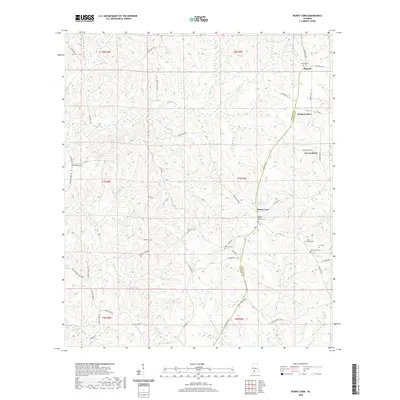
2020 Map of Burnt Corn
USGS Topo · Published 2020About this map
Burnt Corn serves as a focal point in this landscape where the boundaries of Monroe and Conecuh counties meet. This area of Alabama is defined by its deep genealogical roots, evidenced by numerous burial sites like the Bethany Baptist Church Cem, Puryearville Cem, and the Ramah Cem near the settlement of Ramah. The terrain is etched by a network of creeks including Brushy Cr, Walkers Cr, and Limestone Cr, which historically dictated the placement of early homesteads and connecting routes.
Find a feature on this map
51 named features on this map. Tap any name to fly to it.
Don’t see what you’re looking for? This feature index may not catch every label — zoom into the map to look around manually.
Map Details
Editions of this 2020 Burnt Corn Map
This is the sole edition of this map. No revisions or reprints were ever made.
Other maps of this area

1953 · Andalusia
USGS Topo · 1:250,000

1957 · Andalusia
USGS Topo · 1:250,000

1967 · Beatrice
USGS Topo · 1:24,000

1971 · Belleville
USGS Topo · 1:24,000

1971 · Skinnerton
USGS Topo · 1:24,000

1971 · China
USGS Topo · 1:24,000

1971 · Burnt Corn
USGS Topo · 1:24,000

1971 · Repton
USGS Topo · 1:24,000

1971 · Beatrice
USGS Topo · 1:24,000

1972 · Monroeville
USGS Topo · 1:24,000