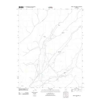
2011 Map of Burnt Corn Spring
USGS Topo · Published 2011About this map
Burnt Corn serves as a central reference point in this high-desert landscape, where seasonal water sources dictate the placement of roads and early habitations. The terrain is defined by dramatic erosional features like Devils Canyon, Pine Spring Canyon, and the prominent Wind Rock Point. A network of unpaved routes, including Indian Rte 8030 and Indian Rte 8068, crisscrosses the plateau, often paralleling the courses of Burnt Corn Wash and Ramhead Wash. These ephemeral drainages are punctuated by critical water points such as Burnt Corn Spring, Salt Water Spring, and the Navajo-named Toh De Coz. This 2011 survey captures a rural landscape where traditional land use and natural landmarks remain central to the geographic identity of the Chinle Agency region.
Find a feature on this map
16 named features on this map. Tap any name to fly to it.
Don’t see what you’re looking for? This feature index may not catch every label — zoom into the map to look around manually.
Map Details
Editions of this 2011 Burnt Corn Spring Map
This is the sole edition of this map. No revisions or reprints were ever made.
Other maps of this area

1883 · Marsh Pass
USGS Topo · 1:250,000

1892 · Marsh Pass
USGS Topo · 1:250,000

1892 · Canyon De Chelly
USGS Topo · 1:250,000

1954 · Shiprock
USGS Topo · 1:250,000

1956 · Marble Canyon
USGS Topo · 1:250,000

1958 · Shiprock
USGS Topo · 1:250,000

1959 · Shiprock
USGS Topo · 1:250,000

1959 · Marble Canyon
USGS Topo · 1:250,000

1961 · Marble Canyon
USGS Topo · 1:250,000
1967 · Whippoorwill Spring
USGS Topo · 1:24,000