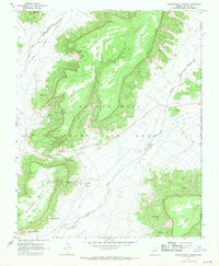
1967 Map of Whippoorwill Spring
USGS Topo · Published 1969About this map
Whippoorwill Spring Mesa and Balakai Mesa dominate this 1967 survey of the Navajo Hopi Joint Use Area Indian Reservation. The landscape is defined by its water sources and the high desert plateaus that rising above the Polacca Wash. Small clusters of activity and traditional dwellings are marked by labels such as Burnt Corn, Set Betoh, and Dah Yaz Nos Cly, while the local infrastructure is anchored by the Whippoorwill Sch. The map records several named water features essential to life in this arid region, including Deneh Challis Spring, White Horse Spring, and Peaches Spring. Cultural markers are sparse but significant, with a single Grave noted near Little Water Well and several family-named locations like Willa Zhinni Toh and Woosh Clo Dee Toh appearing near the southern mesa edges.
Find a feature on this map
26 named features on this map. Tap any name to fly to it.
Don’t see what you’re looking for? This feature index may not catch every label — zoom into the map to look around manually.
Map Details
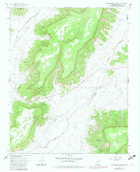
Editions of this 1967 Whippoorwill Spring Map
2 editions found
Other maps of this area

1883 · Marsh Pass
USGS Topo · 1:250,000

1883 · Tusayan
USGS Topo · 1:250,000

1886 · Tusayan
USGS Topo · 1:250,000

1886 · Fort Defiance
USGS Topo · 1:250,000

1892 · Fort Defiance
USGS Topo · 1:250,000

1892 · Marsh Pass
USGS Topo · 1:250,000

1892 · Canyon De Chelly
USGS Topo · 1:250,000

1947 · Flagstaff
USGS Topo · 1:250,000

1954 · Shiprock
USGS Topo · 1:250,000

1954 · Flagstaff
USGS Topo · 1:250,000
Featured Places
- Chinle Agency, AZ
- Fort Defiance Agency
- Whippoorwill Springs, Chinle Agency
- Navajo County, AZ
- Apache County, AZ