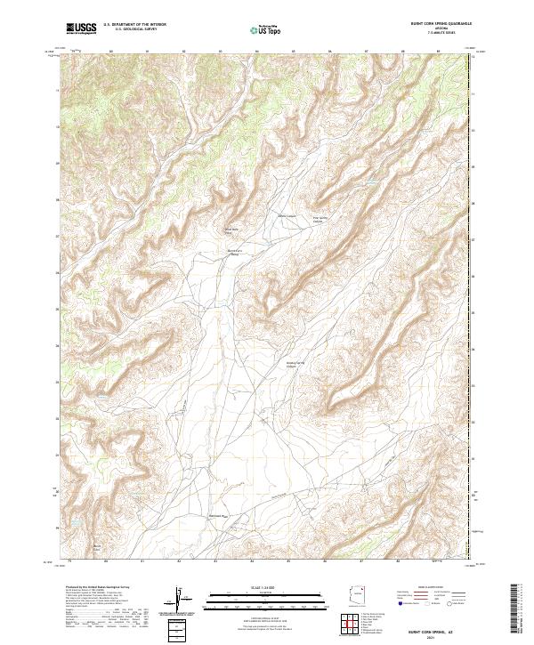
2021 Map of Burnt Corn Spring
USGS Topo · Published 2021About this map
Burnt Corn sits at the southern edge of a landscape defined by deep drainages and significant hydrological features in Navajo County. This area is characterized by the broad Burnt Corn Valley and the prominent Wind Rock Point, which overlooks a network of canyons including Devils Canyon and Pine Spring Canyon. The presence of several named water sources, such as Toh De Coz and Toh-Ha Tsil Dize, indicates a terrain where water management and natural springs were central to the local geography. The transportation network is anchored by Indian Rte 8068 and Indian Rte 8069, cutting through the townships to connect isolated points in this complex topography. Researchers will find interest in the specific placement of Burnt Corn Spring and Donkey Spring Canyon, which trace the historical movement and settlement patterns within the Navajo region.
Find a feature on this map
21 named features on this map. Tap any name to fly to it.
Don’t see what you’re looking for? This feature index may not catch every label — zoom into the map to look around manually.
Map Details
Editions of this 2021 Burnt Corn Spring Map
This is the sole edition of this map. No revisions or reprints were ever made.
Other maps of this area

1883 · Marsh Pass
USGS Topo · 1:250,000

1892 · Marsh Pass
USGS Topo · 1:250,000

1892 · Canyon De Chelly
USGS Topo · 1:250,000

1954 · Shiprock
USGS Topo · 1:250,000

1956 · Marble Canyon
USGS Topo · 1:250,000

1958 · Shiprock
USGS Topo · 1:250,000

1959 · Shiprock
USGS Topo · 1:250,000

1959 · Marble Canyon
USGS Topo · 1:250,000

1961 · Marble Canyon
USGS Topo · 1:250,000
1967 · Whippoorwill Spring
USGS Topo · 1:24,000