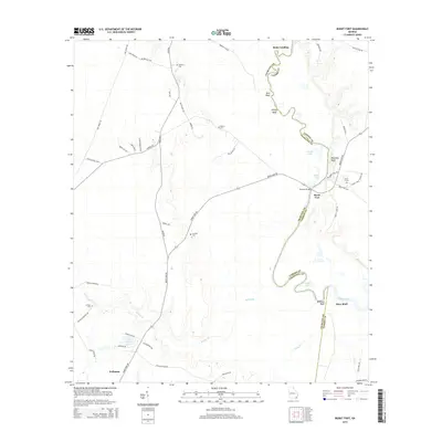
2014 Map of Burnt Fort
USGS Topo · Published 2014About this map
The Satilla River meanders along the boundary of Charlton and Camden Counties, defining a landscape shaped by river landings and high river bluffs. Near the eastern bend, the historic settlement of Burnt Fort serves as a focal point, surrounded by family and community landmarks like Burnt Ft Cem and Magnolia Bluff. This 2014 survey records a network of rural roads such as Burnt Fort Rd and River Rd that link isolated cemeteries and small water bodies across the lowland terrain.
Find a feature on this map
56 named features on this map. Tap any name to fly to it.
Don’t see what you’re looking for? This feature index may not catch every label — zoom into the map to look around manually.
Map Details
Editions of this 2014 Burnt Fort Map
This is the sole edition of this map. No revisions or reprints were ever made.
Other maps of this area

1917 · Nahunta
USGS Topo · 1:62,500

1917 · Boulogne
USGS Topo · 1:62,500

1918 · Folkston
USGS Topo · 1:62,500

1918 · Nahunta
USGS Topo · 1:62,500

1919 · Boulogne
USGS Topo · 1:62,500

1946 · Brunswick
USGS Topo · 1:250,000

1948 · Jacksonville
USGS Topo · 1:250,000

1948 · Brunswick
USGS Topo · 1:250,000

1953 · Waycross
USGS Topo · 1:250,000

1954 · Valdosta
USGS Topo · 1:250,000