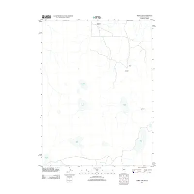
2011 Map of Burnt Lake
USGS Topo · Published 2011About this map
Worland Ranch and its neighboring Worland Canyon mark the eastern reaches of this high desert terrain in Washoe County. The landscape is defined by its seasonal hydrology, characterized by numerous ephemeral playas and water sources such as Dry Steer Lake, Willow Lake, and the provocatively named SOB Lake. These alkali flats and basins, including Garden Lake and the eponymous Burnt Lake, reflect the harsh interior drainage patterns of the Great Basin. Human activity is sparse but evident through localized infrastructure like the Lackerman Airstrip and remote thoroughfares such as Duck Lake Loop and Buckhorn Rd. Natural water sources, critical for ranching and wildlife in this arid environment, are scattered throughout, from the Burnt Lake Spring to the secluded Fish Spring and Rowland Spring.
Find a feature on this map
17 named features on this map. Tap any name to fly to it.
Don’t see what you’re looking for? This feature index may not catch every label — zoom into the map to look around manually.
Map Details
Editions of this 2011 Burnt Lake Map
This is the sole edition of this map. No revisions or reprints were ever made.
Other maps of this area

1886 · Alturas
USGS Topo · 1:250,000

1886 · Honey Lake
USGS Topo · 1:250,000

1886 · Granite Range
USGS Topo · 1:250,000

1889 · Long Valley
USGS Topo · 1:250,000

1891 · Honey Lake
USGS Topo · 1:250,000

1892 · Alturas
USGS Topo · 1:250,000

1893 · Honey Lake
USGS Topo · 1:250,000

1894 · Granite Range
USGS Topo · 1:250,000

1954 · Observation Peak
USGS Topo · 1:62,500

1954 · Vya
USGS Topo · 1:250,000