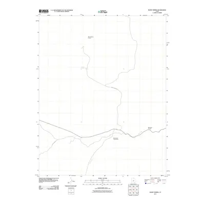
2011 Map of Burnt Spring
USGS Topo · Published 2011About this map
Burnt Spring and Red Cone Spring serve as critical water points in this arid stretch of San Juan County, Utah. The landscape is defined by its deep drainage systems, including the winding Burnt Spring Canyon and the prominent North Fork Castle Wash. The presence of these named springs suggests their importance to cattle ranching or transit in a region where surface water is scarce. Accessibility is provided by desert tracks such as Nokai Dome Rd and Burnt Springs Rd, which navigate the high-desert terrain near Muleshoe Canyon. This 2011 survey documents the persistent pathways and hydrological markers used by locals and explorers alike, showing how Castle Creek carves through the mesa country.
Find a feature on this map
8 named features on this map. Tap any name to fly to it.
Don’t see what you’re looking for? This feature index may not catch every label — zoom into the map to look around manually.
Map Details
Editions of this 2011 Burnt Spring Map
This is the sole edition of this map. No revisions or reprints were ever made.
Other maps of this area

1886 · Henry Mountains
USGS Topo · 1:250,000

1892 · Henry Mountains
USGS Topo · 1:250,000

1952 · Mancos Mesa
USGS Topo · 1:62,500

1953 · Lake Canyon
USGS Topo · 1:62,500

1953 · Mt. Ellsworth
USGS Topo · 1:62,500

1954 · White Canyon 3 SE
USGS Topo · 1:24,000

1954 · White Canyon 3 SW
USGS Topo · 1:24,000

1954 · Clay Hills 2 SW
USGS Topo · 1:24,000

1954 · Clay Hills 2 NW
USGS Topo · 1:24,000

1954 · Clay Hills 2 NE
USGS Topo · 1:24,000