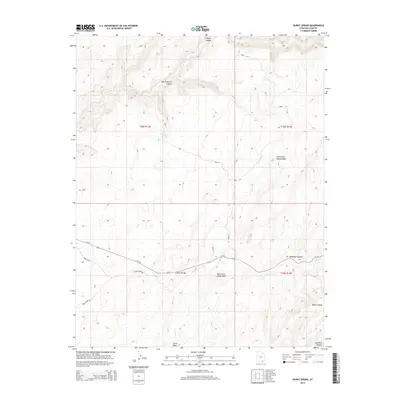
2014 Map of Burnt Spring
USGS Topo · Published 2014About this map
Burnt Spring and Red Cone Spring provide rare water sources within this high-desert canyon system on the Red Rock Plateau. The landscape is defined by the deep incisions of Moqui Canyon and Burnt Spring Canyon to the north, while the southern half of the sheet is traversed by the winding route of Ut-276. This highway serves as the primary modern artery through a complex network of dry drainages, including North Fork Castle Wash and the Nokai Wash. The terrain is marked by traditional cattle-range landmarks like Muleshoe Canyon and Mikes Canyon. Remote access is facilitated by primitive tracks such as the Nokai Dome Rd, which skirts the southern edge of the plateau, tracing the high ground between Castle Cr and the larger wash systems.
Find a feature on this map
19 named features on this map. Tap any name to fly to it.
Don’t see what you’re looking for? This feature index may not catch every label — zoom into the map to look around manually.
Map Details
Editions of this 2014 Burnt Spring Map
This is the sole edition of this map. No revisions or reprints were ever made.
Other maps of this area

1886 · Henry Mountains
USGS Topo · 1:250,000

1892 · Henry Mountains
USGS Topo · 1:250,000

1952 · Mancos Mesa
USGS Topo · 1:62,500

1953 · Lake Canyon
USGS Topo · 1:62,500

1953 · Mt. Ellsworth
USGS Topo · 1:62,500

1954 · White Canyon 3 SE
USGS Topo · 1:24,000

1954 · White Canyon 3 SW
USGS Topo · 1:24,000

1954 · Clay Hills 2 SW
USGS Topo · 1:24,000

1954 · Clay Hills 2 NW
USGS Topo · 1:24,000

1954 · Clay Hills 2 NE
USGS Topo · 1:24,000