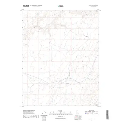
2023 Map of Burnt Spring
USGS Topo · Published 2023About this map
Burnt Spring and Red Cone Spring serve as critical water points in this arid stretch of the Red Rock Plateau within San Juan County. The landscape is defined by a complex drainage network where Castle Wash and its North Fork cut through the high desert. To the south, the terrain rises toward the Clay Hills and drops into the depths of Mikes Canyon. This modern topographic survey reveals the limited human footprint in this remote region, where transportation is restricted to the unpaved corridors of Nokai Dome Rd and Burnt Springs Rd. The map illustrates the classic erosional features of the Colorado Plateau, showing how water has carved distinct landmarks like Moqui Canyon and Muleshoe Canyon into the surrounding plateau.
Find a feature on this map
13 named features on this map. Tap any name to fly to it.
Don’t see what you’re looking for? This feature index may not catch every label — zoom into the map to look around manually.
Map Details
Editions of this 2023 Burnt Spring Map
This is the sole edition of this map. No revisions or reprints were ever made.
Other maps of this area

1886 · Henry Mountains
USGS Topo · 1:250,000

1892 · Henry Mountains
USGS Topo · 1:250,000

1952 · Mancos Mesa
USGS Topo · 1:62,500

1953 · Lake Canyon
USGS Topo · 1:62,500

1953 · Mt. Ellsworth
USGS Topo · 1:62,500

1954 · White Canyon 3 SE
USGS Topo · 1:24,000

1954 · White Canyon 3 SW
USGS Topo · 1:24,000

1954 · Clay Hills 2 SW
USGS Topo · 1:24,000

1954 · Clay Hills 2 NW
USGS Topo · 1:24,000

1954 · Clay Hills 2 NE
USGS Topo · 1:24,000