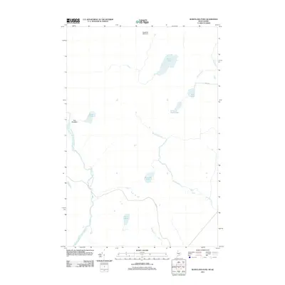
2011 Map of Burntland Pond
USGS Topo · Published 2011About this map
Lac Frontiere sits along the international border in this remote northern landscape where water shapes every boundary. The Northwest Branch Saint John River winds through the western section of the terrain, while the drainage of Burntland Brook and Depot Stream connects a network of smaller water bodies including Burntland Pond, Mud Pond, and Beam Pond. To the north, the elevation rises toward Sugarloaf Mountain, overlooking the paired basins of Presley Lake and Little Presley Lake.
Find a feature on this map
14 named features on this map. Tap any name to fly to it.
Don’t see what you’re looking for? This feature index may not catch every label — zoom into the map to look around manually.
Map Details
Editions of this 2011 Burntland Pond Map
This is the sole edition of this map. No revisions or reprints were ever made.
Other maps of this area

1954 · Presque Isle
USGS Topo · 1:250,000

1955 · Depot Lake
USGS Topo · 1:62,500

1955 · Beaver Pond
USGS Topo · 1:62,500

1958 · Presque Isle
USGS Topo · 1:250,000

1960 · Presque Isle
USGS Topo · 1:250,000

1962 · Quebec
USGS Topo · 1:250,000

1976 · Depot Lake
USGS Topo · 1:24,000
1977 · St. Adalbert
USGS Topo · 1:24,000
1977 · Burntland Pond
USGS Topo · 1:24,000
1986 · Mary L Pond
USGS Topo · 1:24,000