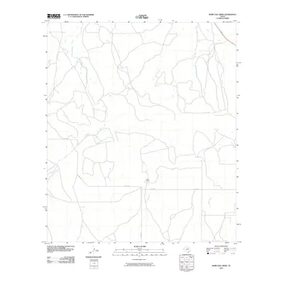
2010 Map of Burr Oak Creek
USGS Topo · Published 2010About this map
Kickapoo Creek and Burr Oak Creek dominate this landscape in Tom Green County, where the network of drainages defines the rural layout of the region. The map captures the area during a period of steady ranching activity, highlighted by the central location of the Slator Ranch. This ranching footprint is connected by a sparse grid of county roads, including Co RD 2275 and Co RD 2246, which facilitate movement between the various creek basins. The presence of smaller waterways like Frog Pond Creek, Welch Creek, and Brady Creek suggests a terrain shaped by seasonal water flow, essential for the livestock operations that characterize this part of West Texas. This 2010 survey by the U.S. Geological Survey provides an overview of the property boundaries and land use patterns common in the early 21st century.
Find a feature on this map
8 named features on this map. Tap any name to fly to it.
Don’t see what you’re looking for? This feature index may not catch every label — zoom into the map to look around manually.
Map Details
Editions of this 2010 Burr Oak Creek Map
This is the sole edition of this map. No revisions or reprints were ever made.
Other maps of this area

1892 · San Angelo
USGS Topo · 1:125,000

1892 · Eden
USGS Topo · 1:125,000

1896 · Eden
USGS Topo · 1:125,000

1954 · Brownwood
USGS Topo · 1:250,000

1954 · San Angelo
USGS Topo · 1:250,000

1957 · Eola
USGS Topo · 1:62,500

1958 · San Angelo
USGS Topo · 1:250,000

1965 · San Angelo
USGS Topo · 1:250,000
1967 · Millersview SW
USGS Topo · 1:24,000
1970 · Live Oak
USGS Topo · 1:24,000