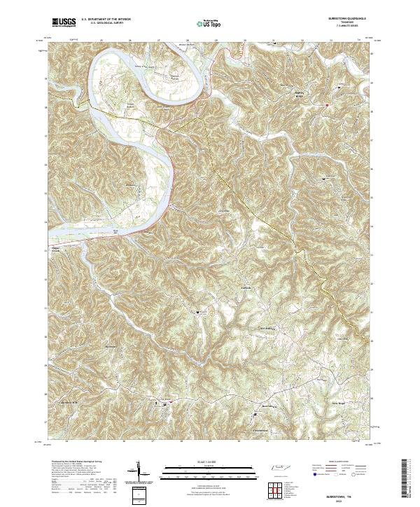
2022 Map of Burristown
USGS Topo · Published 2022About this map
Burristown and the surrounding river bottoms of the Cumberland River define this portion of the Tennessee landscape where the borders of Clay and Jackson counties meet. The river carves a dramatic path through the region, creating prominent landforms like Turkey Creek Island and the striking Seven Sisters Bluff. Agricultural life is concentrated in the lowlands such as Tinsley Bottom and Plumlee Bottom, while the upland ridges are crisscrossed by a network of hollows and named ridges, including Baptist Ridge and Turkeytown Ridge.
Find a feature on this map
137 named features on this map. Tap any name to fly to it.
Don’t see what you’re looking for? This feature index may not catch every label — zoom into the map to look around manually.
Map Details
Editions of this 2022 Burristown Map
This is the sole edition of this map. No revisions or reprints were ever made.
Other maps of this area

1897 · Standingstone
USGS Topo · 1:125,000

1898 · Standingstone
USGS Topo · 1:125,000

1924 · Lillydale
USGS Topo · 1:62,500

1925 · Gainesboro
USGS Topo · 1:62,500

1926 · Lillydale
USGS Topo · 1:62,500

1929 · Lillydale
USGS Topo · 1:62,500

1929 · Gainesboro
USGS Topo · 1:62,500

1929 · Tompkinsville
USGS Topo · 1:62,500

1951 · Windle
USGS Topo · 1:24,000
1955 · Hilham
USGS Topo · 1:24,000