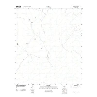
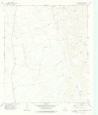
2013 Map of Burro Canyon
USGS Topo · Published 2013About this map
Pezuna del Caballo dominates this high-desert landscape in Culberson County, where the terrain is defined by a complex network of arroyos and drainage basins. Remote outposts like Roberts Camp and water management features such as Boulder Tank and Middle Tank illustrate the infrastructure necessary for livestock and travel in this arid environment. The map details numerous named canyons including Bitter Well Canyon and No Mans Canyon, reflecting a topography that challenged early navigation and required reliance on specific landmarks like Cooky Hat Point. Access through this section of the Trans-Pecos is primarily marked by Stone Rd, which skirts the southern edge of Burro Canyon. This survey provides a modern look at long-established geographical features, from the natural formation of Janes Window to the isolated utility of Twin Tanks.
Find a feature on this map
16 named features on this map. Tap any name to fly to it.
Don’t see what you’re looking for? This feature index may not catch every label — zoom into the map to look around manually.
Map Details
Editions of this 2013 Burro Canyon Map
This is the sole edition of this map. No revisions or reprints were ever made.
Other maps of this area

1906 · Van Horn
USGS Topo · 1:125,000

1954 · Van Horn
USGS Topo · 1:250,000

1958 · Van Horn
USGS Topo · 1:250,000

1973 · Chico Draw East
USGS Topo · 1:24,000

1973 · Bitter Well Mountain
USGS Topo · 1:24,000
1973 · Delaware Ranch
USGS Topo · 1:24,000

1973 · Burro Canyon
USGS Topo · 1:24,000
1973 · Seven Heart Gap NW
USGS Topo · 1:24,000
1973 · Emory Corral
USGS Topo · 1:24,000
1973 · Six Bar Ranch
USGS Topo · 1:24,000