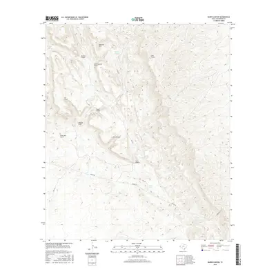
2016 Map of Burro Canyon
USGS Topo · Published 2016About this map
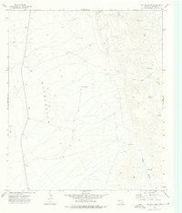
Cooky Hat Point stands as a prominent topographical landmark in this arid portion of Culberson County, where the landscape is defined by an intricate network of drainages and named water catchments. The terrain is deeply incised by features such as No Mans Canyon, Little Codorniz Canyon, and Bitter Well Canyon, which dictate the movement of ranching operations and travelers. This 2016 survey illustrates a modern environment where water remains the primary concern, evidenced by the strategic placement of Apache Tank, Nester Tank, and Twin Tanks. Human activity is primarily represented by a sparse network of unpaved routes, most notably Stone Rd and Roberto Rd, which navigate the high-relief country near Janes Window and Burro Canyon. The map provides a clear record of the area's contemporary ranching infrastructure and the preservation of traditional local place names.
Find a feature on this map
18 named features on this map. Tap any name to fly to it.
Don’t see what you’re looking for? This feature index may not catch every label — zoom into the map to look around manually.
Map Details
Editions of this 2016 Burro Canyon Map
This is the sole edition of this map. No revisions or reprints were ever made.
Other maps of this area

1906 · Van Horn
USGS Topo · 1:125,000

1954 · Van Horn
USGS Topo · 1:250,000

1958 · Van Horn
USGS Topo · 1:250,000

1973 · Chico Draw East
USGS Topo · 1:24,000

1973 · Bitter Well Mountain
USGS Topo · 1:24,000
1973 · Delaware Ranch
USGS Topo · 1:24,000

1973 · Burro Canyon
USGS Topo · 1:24,000
1973 · Seven Heart Gap NW
USGS Topo · 1:24,000
1973 · Emory Corral
USGS Topo · 1:24,000
1973 · Six Bar Ranch
USGS Topo · 1:24,000