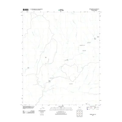
2011 Map of Burro Mesa
USGS Topo · Published 2011About this map
Burro Mesa and Shirttail Mesa dominate this high-desert landscape in Yavapai County, where a complex network of seasonal drainages and water-collection points defines the region's geography. The map reveals an intricate system of ephemeral waterways, led by Burro Creek and the colorfully named Hellzapoppin Creek. Human presence is evidenced primarily by ranching infrastructure, with numerous livestock watering points such as Lovelace Tank, McElheny Tank, and Suicide Tank scattered across the plateaus. Steep terrain is marked by distinct features like Orejans Canyon and Scratch Canyon, while rare water sources like Soda Spring and Upper Cypress Spring provide critical landmarks. The presence of Conger Dam in the southern portion of the quadrangle illustrates managed water resources in this arid environment, alongside named basins like Brushy Basin.
Find a feature on this map
33 named features on this map. Tap any name to fly to it.
Don’t see what you’re looking for? This feature index may not catch every label — zoom into the map to look around manually.
Map Details
Editions of this 2011 Burro Mesa Map
This is the sole edition of this map. No revisions or reprints were ever made.
Other maps of this area

1923 · Signal
USGS Topo · 1:250,000

1942 · Signal
USGS Topo · 1:250,000

1945 · Bagdad
USGS Topo · 1:62,500

1948 · Bagdad
USGS Topo · 1:62,500

1950 · Prescott
USGS Topo · 1:250,000

1954 · Prescott
USGS Topo · 1:250,000

1958 · Prescott
USGS Topo · 1:250,000

1959 · Prescott
USGS Topo · 1:250,000

1960 · Prescott
USGS Topo · 1:250,000

1965 · Prescott
USGS Topo · 1:250,000