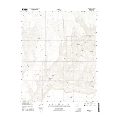
2014 Map of Burro Mesa
USGS Topo · Published 2014About this map
Burro Mesa and the elevated plateaus of Shirttail Mesa define this high-desert region of Yavapai County, where water is the primary driver of the landscape. The geography is marked by a complex network of canyons and drainage systems, including Hellzapoppin Canyon, Seligman Canyon, and Orejans Canyon. These natural corridors feed into significant watercourses such as Burro Cr and Spencer Cr. The presence of numerous livestock tanks and springs, such as Soda Spring and Lovelace Tank, indicates the area's continued use for ranching and grazing. The 2014 survey documents the persistence of these essential water sources in an otherwise arid terrain, showing how names like Bolix Hollow and Happy Hollow Canyon reflect the localized topography. This landscape provides a clear record of the intersection between geologic formations and the practical infrastructure of rural Arizona land management.
Find a feature on this map
40 named features on this map. Tap any name to fly to it.
Don’t see what you’re looking for? This feature index may not catch every label — zoom into the map to look around manually.
Map Details
Editions of this 2014 Burro Mesa Map
This is the sole edition of this map. No revisions or reprints were ever made.
Other maps of this area

1923 · Signal
USGS Topo · 1:250,000

1942 · Signal
USGS Topo · 1:250,000

1945 · Bagdad
USGS Topo · 1:62,500

1948 · Bagdad
USGS Topo · 1:62,500

1950 · Prescott
USGS Topo · 1:250,000

1954 · Prescott
USGS Topo · 1:250,000

1958 · Prescott
USGS Topo · 1:250,000

1959 · Prescott
USGS Topo · 1:250,000

1960 · Prescott
USGS Topo · 1:250,000

1965 · Prescott
USGS Topo · 1:250,000