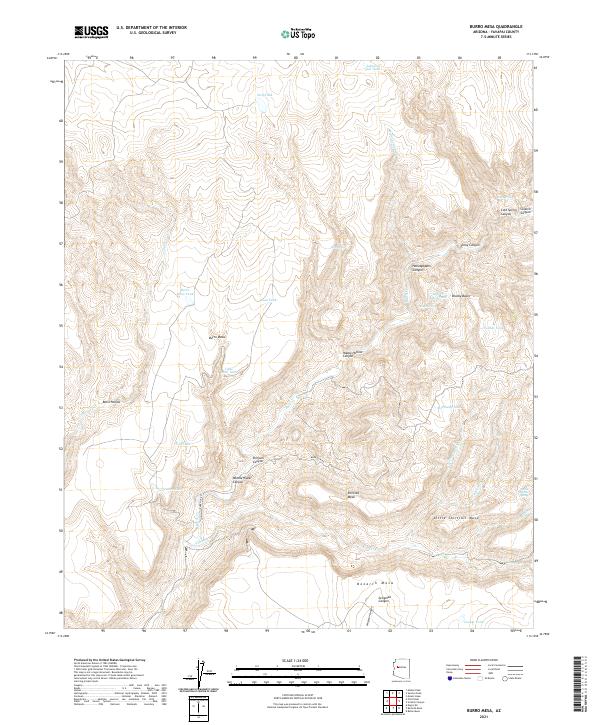
2021 Map of Burro Mesa
USGS Topo · Published 2021About this map
Burro Mesa dominates the northern landscape of this Yavapai County region, providing a flat-topped contrast to the intricate network of drainages that carve through the surrounding terrain. This remote area is defined by its water management systems, where numerous stock tanks like Lovelace Tank, McElheny Tank, and Juan Tank support ranching operations in a landscape defined by seasonal flows and deep canyons. The southern portion of the quadrangle is marked by expansive high ground, including Shirttail Mesa, Little Shirttail Mesa, and Bozarth Mesa, separated by significant topographical breaks such as Seligman Canyon and Conger Cr. Movement through this territory is largely funneled along Burro Cr Rd, which follows the contours of Burro Cr and provides access to the interior canyons like Orejans Canyon and Middle Water Canyon.
Find a feature on this map
42 named features on this map. Tap any name to fly to it.
Don’t see what you’re looking for? This feature index may not catch every label — zoom into the map to look around manually.
Map Details
Editions of this 2021 Burro Mesa Map
This is the sole edition of this map. No revisions or reprints were ever made.
Other maps of this area

1923 · Signal
USGS Topo · 1:250,000

1942 · Signal
USGS Topo · 1:250,000

1945 · Bagdad
USGS Topo · 1:62,500

1948 · Bagdad
USGS Topo · 1:62,500

1950 · Prescott
USGS Topo · 1:250,000

1954 · Prescott
USGS Topo · 1:250,000

1958 · Prescott
USGS Topo · 1:250,000

1959 · Prescott
USGS Topo · 1:250,000

1960 · Prescott
USGS Topo · 1:250,000

1965 · Prescott
USGS Topo · 1:250,000