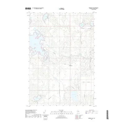
2018 Map of Burrows Lake
USGS Topo · Published 2018About this map
Willow Reservoir dominates the western landscape of this Oneida County region, where complex shorelines meet the winding course of the Tomahawk River. The area is defined by a dense network of glacial lakes and waterways, including McCormick Lake, Hughitt Lake, and the namesake Burrows Lake in the south. This terrain, saturated with wetlands and seasonal drainages like Oelhafen Cr and Clukey Cr, reflects the remote and water-rich character of Northern Wisconsin. The Jack Pine Lookout Tower stands as a notable landmark in the central woods, a vestige of fire observation infrastructure in an area heavily reliant on timber and conservation. A modest network of forest roads, such as Co Hwy Y and Willow Dam Rd, provides access through the dense marshes surrounding Swamp Lake, tracing the early 21st-century footprint of recreational and resource management in the Northwoods.
Find a feature on this map
38 named features on this map. Tap any name to fly to it.
Don’t see what you’re looking for? This feature index may not catch every label — zoom into the map to look around manually.
Map Details
Editions of this 2018 Burrows Lake Map
This is the sole edition of this map. No revisions or reprints were ever made.
Other maps of this area

1938 · Minocqua
USGS Topo · 1:48,000

1938 · Lac Du Flambeau
USGS Topo · 1:48,000

1939 · Lac Du Flambeau
USGS Topo · 1:48,000

1939 · Mc Cord
USGS Topo · 1:48,000

1939 · Cassian
USGS Topo · 1:48,000

1942 · Cassian
USGS Topo · 1:48,000

1946 · Minocqua
USGS Topo · 1:48,000

1946 · Lac Du Flambeau
USGS Topo · 1:48,000

1947 · Mc Cord
USGS Topo · 1:48,000

1949 · Minocqua
USGS Topo · 1:48,000