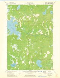
1971 Map of Burrows Lake
USGS Topo · Published 1973About this map
Willow Reservoir dominates the northwestern landscape of this Wisconsin northwoods survey, illustrating the managed water levels that define the region's upper river systems. The Tomahawk River meanders through the central terrain, passing the Halfbreed Rapids as it connects the numerous glacially formed water bodies characteristic of Cassian and Little Rice townships. The map records a transition in forest management and recreation, marked by the presence of the Jack Pine Lookout Tower and a network of logging and access routes like Cedar Falls Road and McCormick Lake Rd.
Find a feature on this map
29 named features on this map. Tap any name to fly to it.
Don’t see what you’re looking for? This feature index may not catch every label — zoom into the map to look around manually.
Map Details
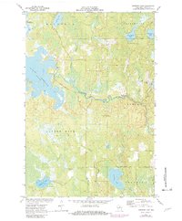
Editions of this 1971 Burrows Lake Map
2 editions found
Other maps of this area

1938 · Minocqua
USGS Topo · 1:48,000

1938 · Lac Du Flambeau
USGS Topo · 1:48,000

1939 · Lac Du Flambeau
USGS Topo · 1:48,000

1939 · Mc Cord
USGS Topo · 1:48,000

1939 · Cassian
USGS Topo · 1:48,000

1942 · Cassian
USGS Topo · 1:48,000

1946 · Minocqua
USGS Topo · 1:48,000

1946 · Lac Du Flambeau
USGS Topo · 1:48,000

1947 · Mc Cord
USGS Topo · 1:48,000

1949 · Minocqua
USGS Topo · 1:48,000